LOWELL HILL
Backwoods Blog;
in the woods and on the road…
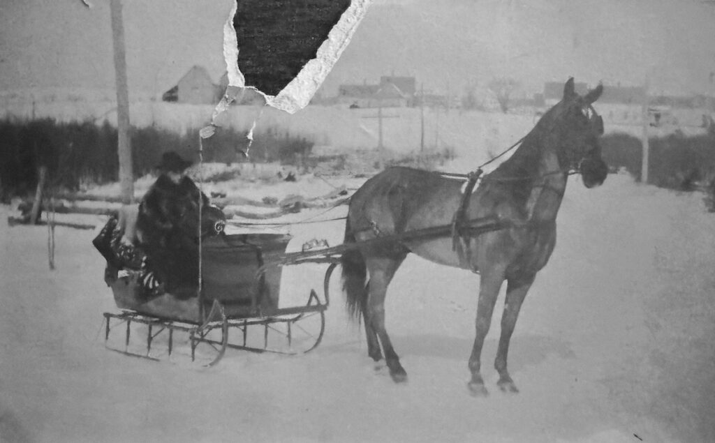
Abner Cowperthwaite on US Route 1 in Monticello (1908)
This photograph was taken on Lowell Hill heading north on US Route 1 entering Monticello, Maine. The gentleman in the pung is Abner Cowperthwaite, who had been visiting his cousin Bill Cowperthwaite and posed for this photo in the middle of the road (apparently there wasn’t much traffic that day). At the bottom of the hill on the left you will see the Hutchinson farm where I grew up. The unfortunate tear in the photograph is in-between the farmhouse and the double barns. This photo taken in 1908 is the earliest image I have seen of the property. What’s interesting about the photo is that it shows the natural contour of the hill before the roadway was raised in 1939. In the photo below, you see Lowell Hill looking south from the kitchen window of our farmhouse taken in 1949. The first structure on the right is the Roy Cowperthwaite house (one of Bill’s sons) and when the road was raised, the original house was moved farther up the hill. The story goes, that old Mrs. Cowperthwaite refused to leave the house during the move and remained in the kitchen drinking a pot of tea.
There was a swamp (or a natural wetlands, as we call it these days) at the bottom of the hill, that encompassed both sides of the road, and then a small rise where it leveled heading towards downtown Monticello. Although I have basically lived on this property all my life, and looked out the kitchen window countless times, I never realized that Lowell Hill was a two-sided hill until I looked at this picture last week! Granted, it is a small rise on the north side, but before the raised road flattened the bottom of the hill, it was a noticeable experience. Suddenly, I am no longer looking at the hill in the same way. The Department of Transportation also raised, widened and flattened the roadway again in the 1990s so Lowell Hill continues with its occasional modifications.
For those of you who may not know, Linda and I (and our two cats) moved into the family farmhouse when my mother entered assisted living in Houlton. She wanted us to take care of the place, and her cat, so that’s what we’ve been doing. We closed down our off-the-grid farmhouse on back of the property, packed a portion of our belongings and here we are. I still go back and forth on an every day or so basis, just to check on things and hang out by the river, but for the most part I’m right here looking out the kitchen window like in the photo below. And with the early arrival of snow this year, that’s pretty much what it looks like…
Almost in the woods,
Dave
December 7, 2023
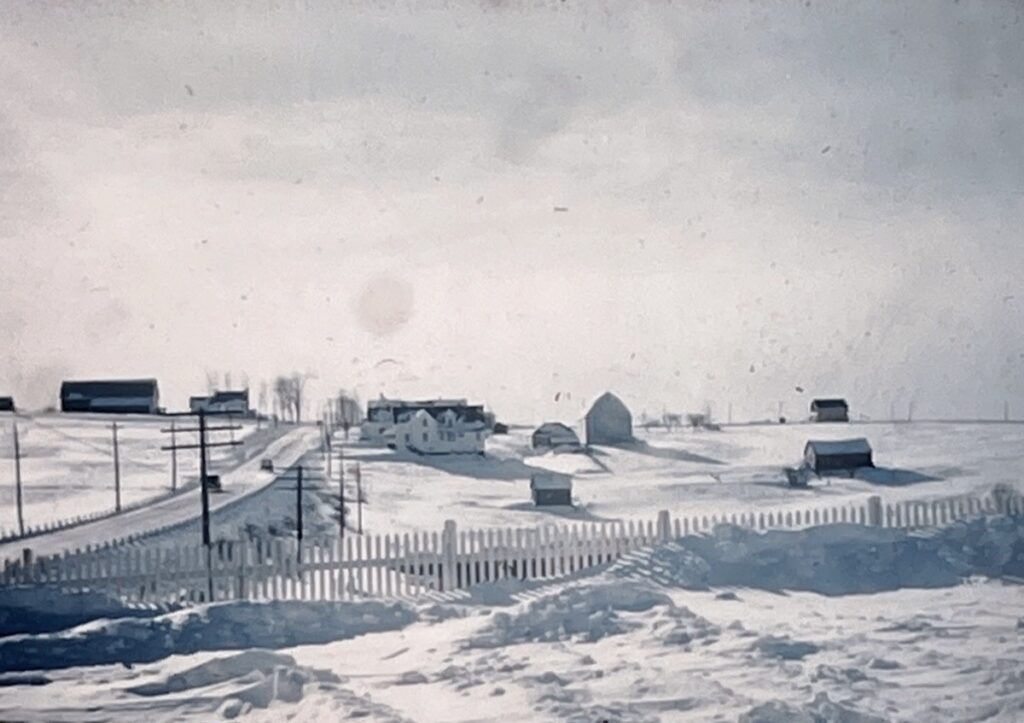
Looking south on US Route 1 in Monticello (1949)
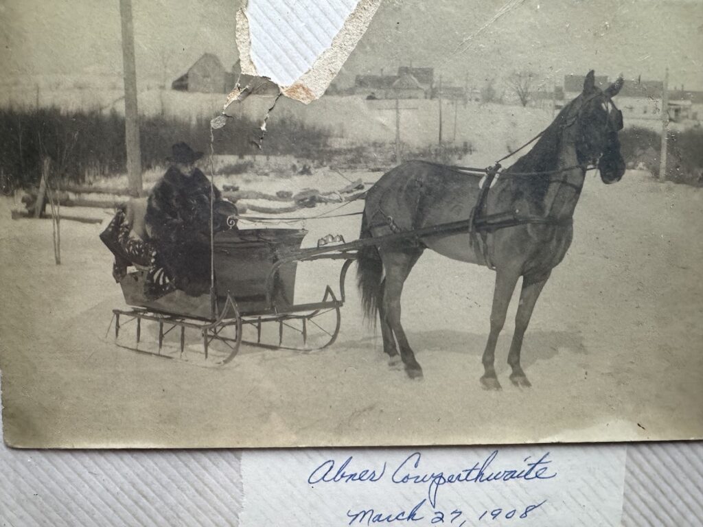
Original photograph from the Roy and Myrtle Cowperthwaite collection
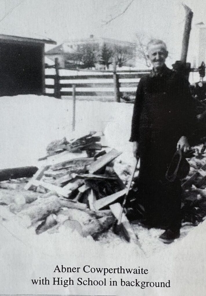
Image from the Monticello Sesquicentennial Book (1996)
In the 1908 picture, your home looks like it is up on a rise, but these days, with the raising of the road over the years, it doesn’t look that way anymore. I’ll have to look more carefully the next time I venture north. The picture of Abner Cowperthwaite with the High School in the background: is that a Monticello High School or is that a picture of the former Houlton H.S., then Lambert School, now G.H.C.S?
The school in the background is the old Monticello High School. It was still being used to house grades 3-6 when I was attending in the 1960s. The modern Wellington School building and gymnasium next door accommodated kindergarten through grade 2. The old school building was torn down by 2000. I’ll include an old photograph of the school in a future post.